 |
|
|
|
COMUNE DI PONZA
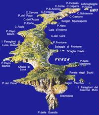
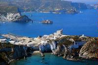
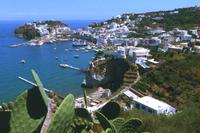
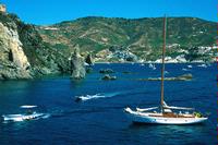
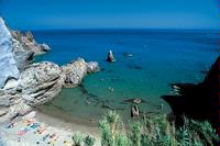
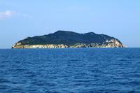
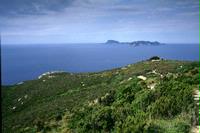
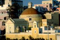
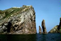
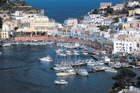
One of the most interesting islands in the Mediterranean Sea, PONZA (located at a lati-tude of 40°54’ N and a longitude of 12°58’ E) stretches to approximately 7,350 metres in length (from Punta della Guardia to Punta dell’Incenso ) and varies in width from a max-imum of 2,000 metres to a minimum of just 200 metres (between Cala d’Inferno and Cala dell’Acqua). Covering a total surface area of approximately 722 hectares, the island can be reached by ferry from Formia, Terracina and San Felice Circeo (in summer), as well as from Anzio, Fiumicino (Roma) and Naples. The magnificent panorama – a view which incorporates both the charm of the pink and white houses of the old fashioned port and the majesty of the surrounding hills – which greets visitors to Ponza on their arrival is one of the most beautiful in the world, while the seabed offers a highly varied and intriguing underwater landscape which includes cliff walls covered in red corals, fields of sea-grasses waving in the current and huge rocks and boulders carpeted with sea lettuce and delicate acetabularia. Circumnavigation of the island enables full appreciation of the amazing variety of caves, grottoes, rocks, coves and bays with which its coast is lined. Heading south east from the port towards Punta della Madonna, the red rock gives way to the tuff cliffs of Pilate’s Grottoes, roman fisheries in which fish were bred in natural pools. Continuing past the Faraglioni della Madonna stacks, which smaller vessels can leave on the port-hand side, as far as the strip of pebbly beach known as Parata degli Scotti which precedes the great stacks of the Faraglioni del Calzone Muto, it is soon possible to see the lighthouse located on top of the high Punta della Guardia. After this magnificent promontory, the coast curves gently as far as Punta del Fieno before opening out into the most beautiful beach on the island, Chiaia di Luna beach. Overlooked by a yellowy-white falaise of over 100 m in height, upon which expert eyes will be able to identify all the various geological ages of the island, Chiaia di Luna beach concludes at Punta Capo Bianco, a wall of light grey tuff which reflects the light of the various hours of the day in a wide range of different colours. After passing the small bay which pre-cedes Scoglio Montagnello, Punta Faraglioni and the ancient peninsula composed of the five stacks of Lucia Rosa, a deep inlet and Punta Capo Bosco introduce the serenity of Cala Feola, one of Ponza’s most beautiful anchorages, and the small port of Le Forna; the clear waters of natural pools reflect the gentle slopes of the terraces and the houses which nestle on them. Separated from Cala Feola by a small promontory, Cala dell’Acqua is closed by Punta del Papa upon which stand the ruins of a fortress dating back to 1772. Once round Punta del Papa, the coast opens into Cala Cavone and Cala Cecata before Punta Beppe Antonio leads to another jewel in the island’s crown: Cala Fonte. Immediately after Cala Fonte lie Cala Felce, Punta dell’Incenso and the 130 metre stretch of sea which separates Ponza from the tiny uninhabited island of Gavi (which has Punta Rossa to the north and Parata to the east). Continuing around the island of Ponza, Cala Gaetano leads to Cala Spaccapolpi (or Cala dello Schiavone), a cove named after the natural arch it houses whose two stacks are joined by a beam of rock known as the “octopus splitter” (spaccapolpi), and the Faraglione of Aniello Antonio. Rounding Punta Nera, Cala d’Inferno is closed by a white-grey rocky wall veined with various colours in which a staircase was dug to connect Le Forna to this stretch of sea and the port prior to the construction of the road. Beyond the Scoglio del Parroco, Cala del Core and Cala Frontone, the sandy Frontone beach leads to Scoglio Ravia and the village of Santamaria. The urban layout of the island of Ponza dates back to the 18th century and, indeed, the semicircular port, designed by Winspeare and built by Francesco Carpi between 1772 and 1793 over the original Roman foundations, Corso Pisacane, a delightful street lined with craft shops and restaurants, and the ancient fortified tower which is now a hotel, are all Bourbon in origin. Traces of Roman domination of the island are found in the water supply system which includes large reservoirs for the collection of rainwater and four aqueducts (some of which date back to times prior Roman settlement of the island). Located approximately 6 miles from the port of Ponza, the island of ZANNONE can on-ly be reached by private boat or one of the small craft offering day trips services to the island in summer. Stretching to a length of 1.6 kilometres and a width of 1.05 kilometres, the island covers a surface area of 102.88 hectares while its highest point, at the top of Monte Pellegrino, stands 192 metres above sea level. With approximately 6 kilometres of coastline, Zannone is part of Circeo National Park and is patrolled by the National Forest Ranger Service. Although it does not take long to circumnavigate the island, even inexpe-rienced observers will appreciate how its rock formations differ from those of Ponza and Palmarola. It is only possible to land on the island in good weather when the sea condi-tions are at their best. The best landing stage is located at Punta del Varo, the headland which lies opposite Ponza. A trip round the island will enable visitors to see Cala delle Grottelle, Scoglio del Monaco, Punta di Levante, Punta del Lauro, Capo Negro, Capo Caccia, Punta del Mariuolo and Punta Lunghetiello, while on the island itself it is possi-ble to explore the ruins of the Benedictine monastery of Santo Spirito and the fisheries made into the rock and connected to the sea by an underwater conduit, accessible only via an external staircase close to Varo. In prehistoric times, the island of Zannone was used to process obsidian from Palmarola. Zannone is inhabited by a small colony of mouflon sheep which were imported years ago from Sardinia The island of PALMAROLA lies 7.3 nautical miles from the port of Ponza, from whence skippered motorboats will take visitors to the island on day trips, and approx-imately 5 miles from Chiaia di Luna beach. Covering a surface area of 136.36 hectares, the island stretches to a maximum length of 2.75 km and a width which varies from 100 m to 300 m. The island is oriented towards the north western coast of Ponza and has a single landing stage at Cala di San Silverio halfway down its western flank. Environmen-tally very similar to Ponza, the island’s landscape is characterized by steep slopes and transparent, uncontaminated waters. At Cala del Porto, a pebble beach protected by the Faraglione di San Silverio is surrounded by the “eyes” of dozens of caves dug by farmers with a view to harnessing the land for agricultural purposes, while offshore, the two great Scogli delle Galere contrast the black obsidian slopes of Monte Tramontana, where pre-historic man collected vitreous lava to make blades, spearheads, knives and other imple-ments. Coming to the island from Circeo and the surrounding area, on the way back home he probably stopped on Ponza and Zannone to take on fresh water and cut the blocks of rock collected on Palmarola. Once round Punta Tramontana, the coast opens into a cove characterized by a series of caves known as Le Cattedrali, delimited by lava columns which plunge deep into the dark green sea, while, beyond Punta delle Brecce, the coast runs gently to Forcina where the red-brown slopes of the mountain are fractured by huge white rocks and a yellow-white stack rises out of the water. Continuing south-wards towards Punta Vardella, past the brightly coloured Cala Brigantina, the heavily eroded Scoglio Suvace and the imposing stacks and caves of Punta di Mezzogiorno, it is possible to admire the natural arch of Scoglio Cappello (now known as Il Fucile) whose architrave collapsed into the sea in the 1960s following a particularly violent storm. After heading offshore towards Scoglio Pallante and then back to the grottoes and caves of the Scoglio di San Silvestro, it is possible to see the Faraglione di San Silvestro, a rocky stack topped by a votive chapel dedicated to Saint Silverius, the patron saint of the island, and connected to the island by a low, cordon of rocks which the sea will probably break through in the not too distant future. PORTS – DOCKS – BERTHING PORTO DI PONZA: 40°53' 84 N and 12°57' 96 E. Delimited to the north by a rocky mass known as the Molo Musco, the port is protected from the sea by a string of rocks which run parallel to the quayside. Although the Tenente Di Fazio quay to the south of the port is only suitable for small pleasure craft as a result of its restricted draft, the new quay, which also runs along the southern side of the port, can accommodate vessels with a draft of up to 6 metres. In summer, pleasure craft can moor on specially erected pon-toons. Seabed: sandy - Berths: 200 (on floating piers) - Max length: 35m CALA FEOLA: 40°55' 26 N and 12°57' 75 E. A natural cove protected by a partially paved quayside, this anchorage is generally used by the local fishing fleet although some moorings shielded from the winds of 2nd and 3rd quadrants are available within the port. Seabed: sandy - Draft: 10 - 15 metres on moorings. Local Maritime Office Via Molo Musco 7, tel. and fax 077180027 - e-mailponza@guardiacostiera.it Ferry Services: CAREMAR: ferry and hydrofoil services from Formia and Anzio (www.caremar.it) - VETOR: hydrofoil services from Formia and Anzio (www.vetor.it) - PONTINA NAVIGAZIONE: passenger motorboat services from S Felice Circeo (www.circeoponza.it) - SNAP e SNIP: ferry services from Terracina (www.snapnavigazione.it) - NAVIGAZIONE LIBERA DEL GOLFO: express passen-ger ferry services from Terracina and Naples (www.navlib.it) - LINEE BUONO: ex-press passenger ferry services from Terracina - ALILAURO: catamaran services from Formia; hydrofoil services from Naples and Fiumicino (www.alilauro.it) - SNAV: ferry and hydrofoil services from Naples (www.snav.it) - AQUA AIRLINES: seaplane ser-vices from Roma Urbe airport (www.aquaairlines.com) |
 |
La Riviera d'Ulisse - Ente Turistico di Terzo Settore
Servizio IAT - Informazione ed Assistenza al Turista Largo Jacopo Peri, 70 - Latina - tel. 0773480672 - 0773484502 - 06/69281723 www.larivieradulisse.it - www.larivieradulisse.it - www.latinaeventi.it - info@latinaturismo.it a cura di Cooperiamo Insieme Cooperativa Sociale P.I. 02812020598 |
powered by iper.net |
|
