COMUNE DI TERRACINA
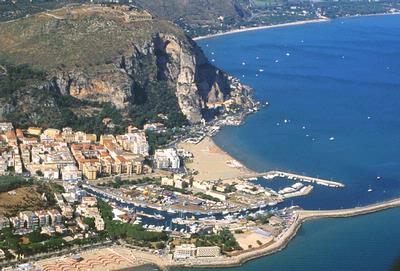
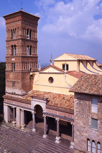
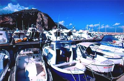
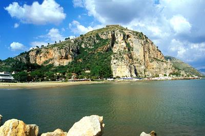
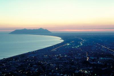
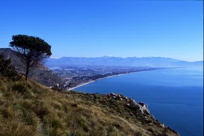
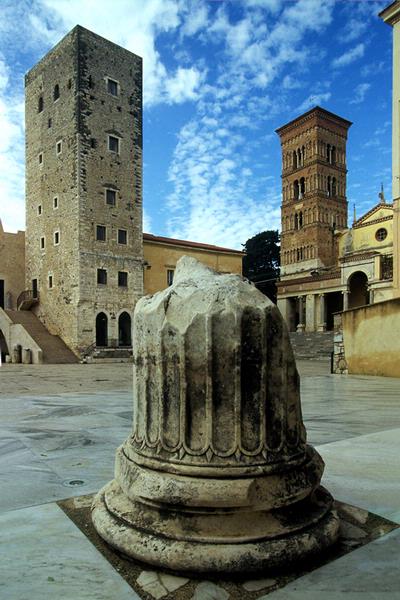
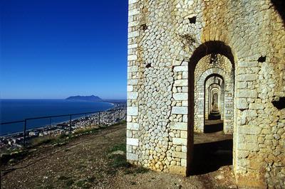
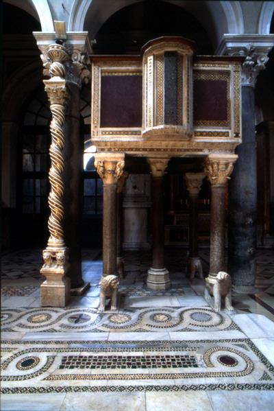
Slightly more than 100 kilometres from Rome and 120 kms from Naples, Terracina lies on about 15 kms. Of coastline, along the wide gulf marked by the Circeo and Gaeta promontories. A visual summary of the history of Terracina is afforded by the present-day main plaza, Piazza del Municipio, which has sections of the ancient Roman Appian Way, the Republican Age (or Emilian) Forum with its original pavement, traces of the Roman theatre, and the capitolium. The Middle Age is represented by the splendid Ca-thedral dedicated to the patron St. Cesareo, Palazzo Venditti, the Torre dei Rosa, now the Civic Museum, and Castello Frangipane. Nearby are the 18th-century Palazzo Braschi and Palazzo della Bonifica, and the modern section with the Municipio, the town hall. Piazza del Municipio also offers a view of the two symbols of Terracina, the sea and the Temple of Jupiter Anxur (Natural Monument); the latter was part of the monumental complex of the ancient acropolis, situated on the top of Monte S.Angelo, which affords a breathtaking view of the entire gulf and the Pontine Islands; indeed, on especially clear days you can see the jewels of Campania, the islands of Ischia and Capri. The modern town - which grew up around the Borgo Pio suburb, founded in the late 18th-century – also has some Roman ruins. These lie in the Porto di Traiano (Trajan’s Port), the Foro Severiano forum and the rock known as Pisco Montano, the southern gate of the city that the Emperor Trajan made to open the Appian Way to the sea. Here Terracina clearly manifests its vocation as tourist city with its long sand bank with bathing establishments, parks, hotels and villas for rent; the colourful fishermen’s port-canal and two basins for pleasure-craft, and the arm of the port where the ships depart for Ponza and Ventotene. Other boating areas are the large Badino canal and the banks of the Sisto River. These who enjoys the countryside as well as the sea need only venture a few miles into the interior to reach two interesting places: the hilly valley of Camposoriano (Natural Monument), and the Madonna di Monte Leano, which overlooks the Pontine Marshes plain. Terracina began as a town of fishermen and farmers, and the various religious and civic celebrations held here are related to these origins
www.comune.terracina.lt.it
PORTS – BERTHING – DOCKS
PORT OF TERRACINA (canal port) - coordinates 41°16' 93 N, 13°15' 68 E. Protected to the south by the Gregoriano Pier and to the north by a breakwater, the port has two in-ternal docks and quays along both shores of the canal, mostly occupied by fishing vessels. Seabed: sandy - Depth: 0.6-3 m. at the quay – Boat berths: 80 in the inner dock and 120 in the outer dock - Max. length: 14 m - FOCE SISTO (canal port) - coordinates 41°15' 77 N, 13°09' 03 E. Foce Sisto is formed by two steep banks unsuitable for mooring; along the first stretch of approx. 300 m from the mouth inland there are two 2 areas licensed for mooring pleasure craft. Seabed: sandy – Boat berths: 250 - Max. length: 6 m. PORTO BADINO (canal port) - coordinates 41°16' 75 N, 13°12' 15 E. Formed by two quays approx. 300 m long, entirely serviced under licence for mooring and stationing of pleasure craft. Along both banks there are numerous pontoons leased out to private customers, for mooring small and medium-sized craft, and jetties. Seabed: sandy - Depth: 1-4 m. at the quay berths – Boat berths: 800 - Max. length: 18 m.
District Maritime Office, Via del Molo 4, tel. 0773720060-1, fax 0773720061 - e-mail: terracina@guardiacostiera.it