COMUNE DI FORMIA
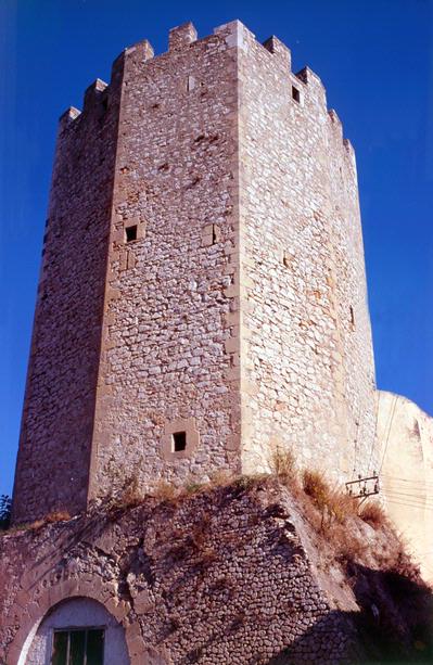
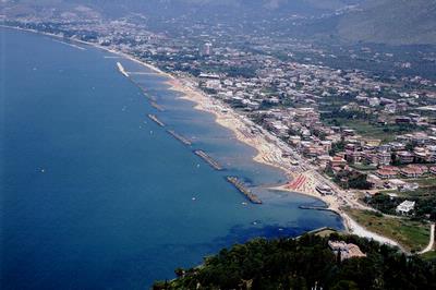
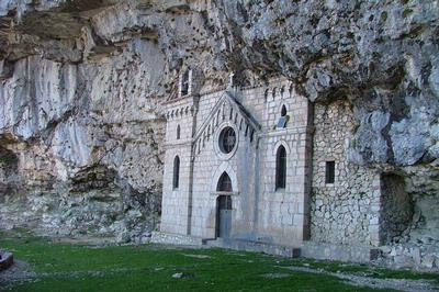
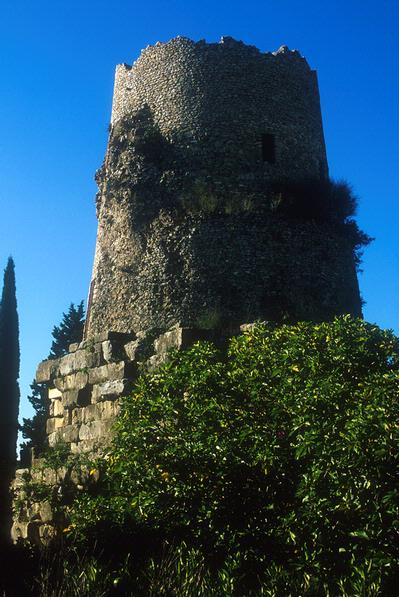
The origins of Formia are linked to the legend of Troy and Ulysse’s travels on his return journey. Of pre-Italic and Aurunco formation, as demonstrated by the ring of polygonal walls and numerous other remains scattered all over the territory, Formia, placed in the centre of the Gulf of Gaeta and protected from the cold winds by the high hills, was, even in Roman times, a popular holiday resort and conserves the ruins of numerous villas, and was chosen by such an important figure as Cicero, who made the area his place of eternal rest. Extending between the sea and the mountain slopes, Formia lies between the beaches of Vindicio to the west and Acquatraverssa, Santo Janni and Giànola (protected area and Blue Oasis) inside the Riviera di Ulisse Regional Park) to the east. The slopes of Monti Aurunci are home to picturesque hamlets such as Maranola, Trivio, Castellonorato and Pénitro. A road climbing from Maranola, leads to Monte Redentore (1252 mt.) and the homonymous statue, where one can enjoy a breathtaking view, and through a footpath to the Sanctuary of S.Michele Arcangelo. Formia is strewn with ruins and remains, symbols of the area’s ancient history: the medieval district of Castellone, built upon a pre-roman acropolis; the sea and commercial port and area of Mola, built on roman remains, around a high cylindrical medieval tower; the small roman harbour of Giànola and the Bourbon harbour of Caposele; the Cisternone Romano and the Roman fountain along the Appian Way; remains of roman aqueduct, amphithetare, the Cryptoporticus of the Villa Comunale. As to the main religious buildings, worth visiting the churches of St. Erasmo ( episcopal seat from 4th to 9th century, with the early Christian, Byzantine and Longobard stratifications below), St.Maria La Noce and St. Rocco. Formia is also seat of a National Archaeological Museum, placed in the ground floor of 18th century Palazzo Municipale, which houses many ruins and remains brought to the light all over the surrounding territories.
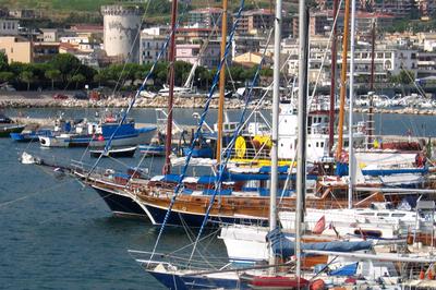
From the main harbor, departures for Ponza and Ventotene (Pontine Islands) by ferries and hydrofoils
www.comune.formia.lt.it
PORTS – DOCKS - BERTHING
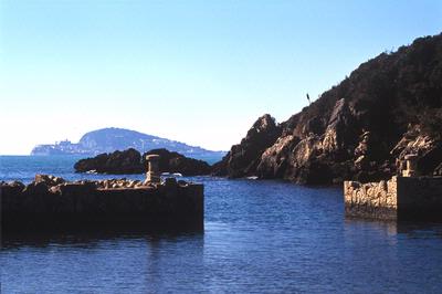
PORTO NUOVO (port/marina) - coordinates 41°15' 17 N, 13°36' 78 E. The port is protected by two L-shaped piers: an outer breakwater to the south and an outer pier to east. There are several pontoons on the inside, besides the quays. Seabed: slimy - Depth: 0.60-5 m. at the quay – Boat berths: 500 - Max. length: 25 m. PORTO CAPOSELE (port/marina) - coordinates 41°14' 95 N, 13°36' 05 E. Protected by two piers, one pointing SE and the other ENE, with approx 200 m of quays and jetties. Seabed: slimy - Depth: 1.20-1.80 m. at the quay – Boat berths: 130 - Max. length: 12 m. LIDO SCOGLIERA - Loc. Vindicio (small docks). Haven for crafts. EX-QUERCIA (small docks): for small fishing/leisure craft. TORRE MOLA (small docks): for small fishing/leisure craft, with several pontoons.
Local Maritime Office, Piazzale Amerigo Vespucci 7, tel. 077121552 - e-mail: for-mia@guardiacostiera.it